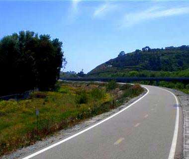
 This trail is a Class I bicycle trail which is open to pedestrians as well. The trail about 9 miles, one way, from the Neptune access (west end) to the eastern-most point at N Sante Fe Ave and SR-76. The trail follows the San Luis Rey River and was the formerly a railroad corridor. This paved and mostly level trail is safe for all age groups, is completely separate from motorized traffic, and is free of stop signs and traffic lights. Please note that there are no lights on this trail and after daylight hours use is discouraged.
This multiuse trail may be used for recreational purposes by other non-motorized users such as hikers, runners, inline skaters, and wheel-chairs. It is not intended for equestrian use due to its design and limited width. Motor vehicles are prohibited. Walkers and runners are welcome to bring their dogs to the trail for exercise as well. Dogs using the trail must be on a leash no longer than 6 feet. If you use the trail with your four-legged friends, please pick up after them to keep the trail enjoyable for everyone!
This trail is the perfect opportunity to bring some binoculars and an Audubon Guide for bird viewing. Speaking of things that fly, this is also a great place to watch the skydivers from the Oceanside Municipal Airport come in for a landing. However, you may hear both of these flyers long before you see them.
The west end of the trail is within a few blocks of the Oceanside Transit Center, where commuters can board the Coaster, Amtrak, and Metrolink trains, or North County Transit District buses, all of which can accommodate bicycles.
For commuter information call:
- North County Transit District: (760) 966-6500
- Metrolink: (800) 371-LINK (5465)
- Coaster: (800) COASTER
San Luis Rey River Trail Map
Access Points
Access 1 – Neptune Way
Amenities
- Street Parking
- Information Kiosk
Access 1 is the western-most entrance and marks the official start of the trail at the 0.0 mile marker. It is within a few blocks of the Oceanside Transit Center, where commuters can board the Coaster, Amtrak, and Metrolink trains, or North County Transit District buses, all of which can accommodate bicycles. This access will eventually link with the Coastal Rail Trail that will run in a north-south direction connecting to Carlsbad and further into San Diego.
Access 2 – Pacific Street
No amenity information.
Access 3 – Benet Road
Amenities
Access 3 lies just west of the Oceanside Municipal Airport. Access the Benet Road entrance off Highway 76. Head east on Highway 76 and turn left on Benet Road. There is no parking lot at this access point.
The Benet Road access is located at mile marker 2.4 on the trail.
Access 4 – Foussat Road
Amenities
- Parking Lot
- Restrooms
- Information Kiosk
Access 4 lies northeast of the Oceanside Municipal Airport and can be accessed off Highway 76. Head east on Highway 76, turn left on Foussat Road, and follow the road to the trail access parking lot connected to Alex Road Skatepark.
Located at mile marker 3.2 on the trail.
Access 5 – Cypress Road
No amenity information.
Access 6 – Douglas Drive
Amenities
Access 6 lies further north and inland at the 5.4 mile marker and may be reached by traveling east on Highway 76. Turn left on Douglas Drive and travel approximately 1 mile. The access and small parking lot is located on the left-hand side of Douglas Drive. Access to the parking lot is not available when traveling north. To safely access the lot and trail, travel to North River Road, turn around and head south. Turn right into the lot at the Douglas Bridge overpass.
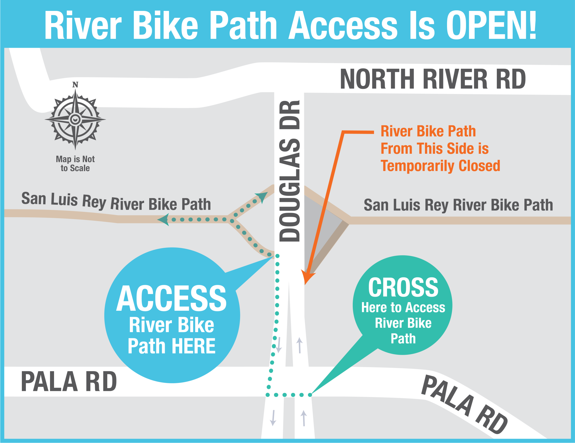
Due to construction the parking lot for the Douglas Drive access point and East entrance to the San Luis Rey River Trail is currently closed. The trail can still be accessed from the Northbound (or Wests) side of Douglas only. Users wishing to go North on Douglas from the Trail must use the pedestrian crossing at Pala Road.
Access 7 – College Boulevard/Mance Buchanon Park
Amenities
- Parking Lot
- Information Kiosk
- Accessible Picnic Tables
- Trash Receptacles
- Restrooms
Access 7 is at Mance Buchanon Park which offers a larger parking lot, a staging area, restrooms, water fountains, shaded picnic tables, shaded grass areas and an additional pathway that loops the park. The College Boulevard access can be reached by traveling east on Highway 76 to Douglas Drive. Turn left on Douglas Drive and travel approximately 1.2 miles. Turn right on North River Road traveling east to College Boulevard. Turn right on College; the trail access is immediately following your right turn.
The College Blvd. access marks the 7.2 mile marker. From College to North Santa Fe Avenue there is an additional 1.8 miles = 9 miles total.
Access 8 – Andrew Jackson Drive
Bike lane detours onto surface street for ¼ mile.
Access 9 – Tyler Street
Bike lane detours onto surface street for ¼ mile.
Access 10 – North Santa Fe Avenue/Highway 76
Amenities
- Parking Lot
- Information Kiosk
- Trash Receptacles
Access 10 is the easternmost access point for the trail.


